Hey everyone!
The following text is our show notes from episode 116. This includes photos that Reuben and Taylor discuss throughout the podcast episode. The photos are also available in the video version accessible on YouTube.
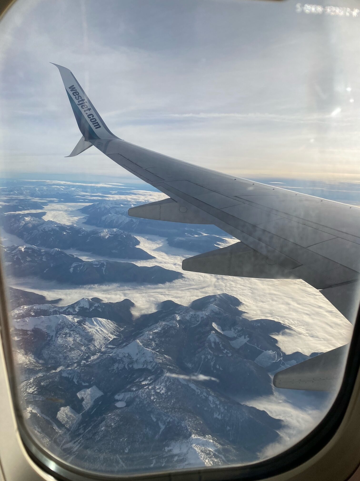
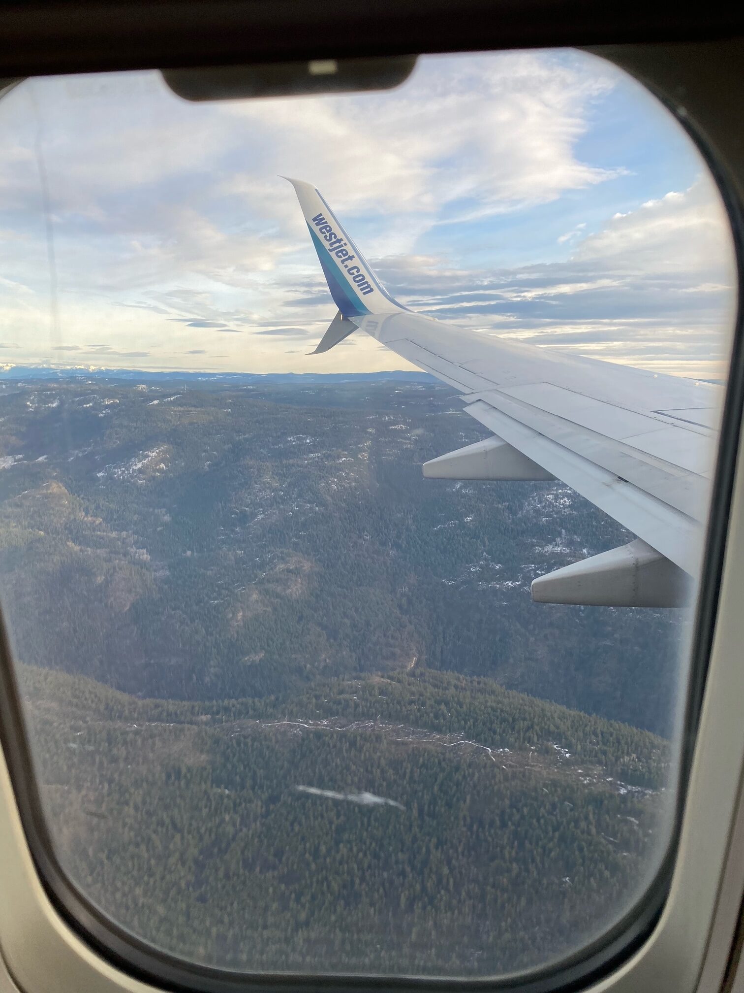
We’ve got an interesting episode focusing on the terrain of Western Canada. I mentioned this to you off the air, but for Christmas, I took my family across part of Canada and as we flew above we got some very interesting glimpses of the landscape. It’s one thing to view it on Google Maps, but being in the air yourself and looking down, you get some pretty awesome sights. These sights I am going to share here with you so you can see for yourself as we discuss this. For those of you following along, you can do so either on the Youtube version where they’ll be displayed in the video or alternatively, you can check out our website blog page, I’ll have a blog post with the photos attached. Side note, just to get it out of the way – we aren’t sponsored or affiliated with West Jet Airlines, so disregard the logo on the wing, as far as I’m concerned they get free advertising for this episode.
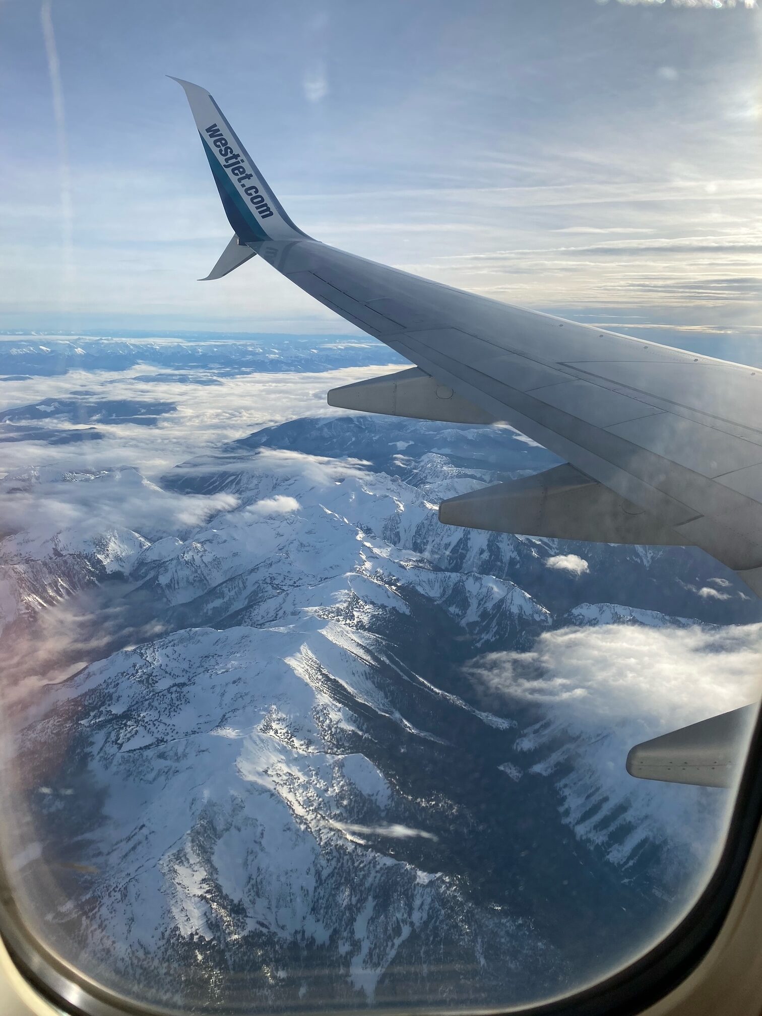
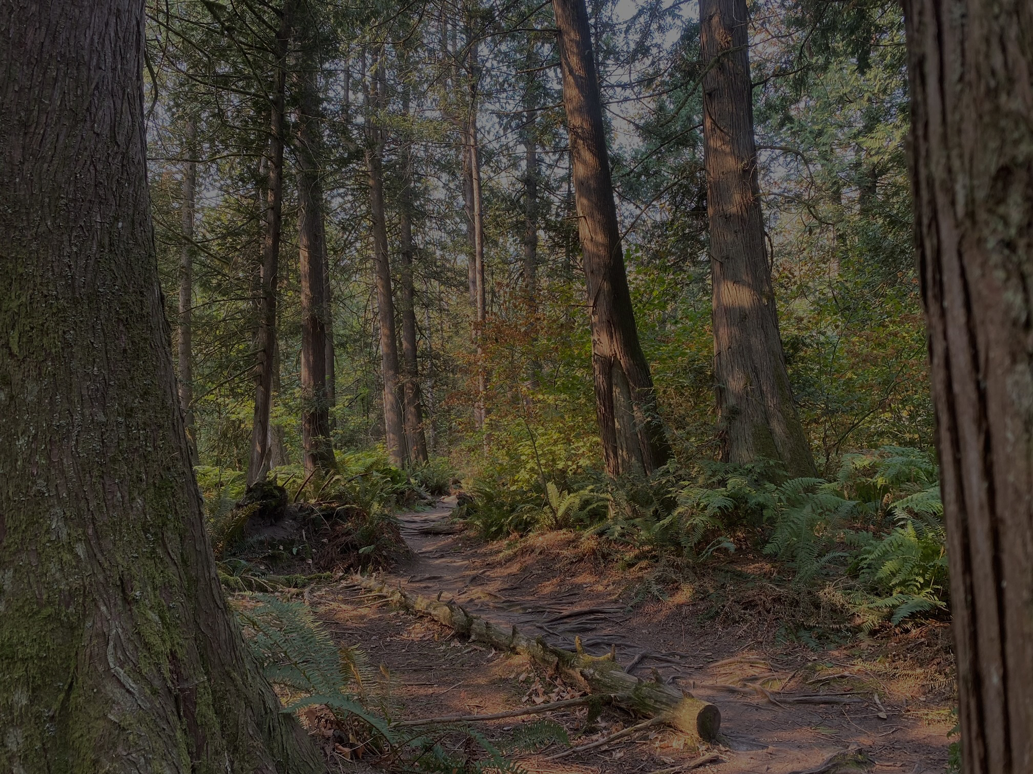
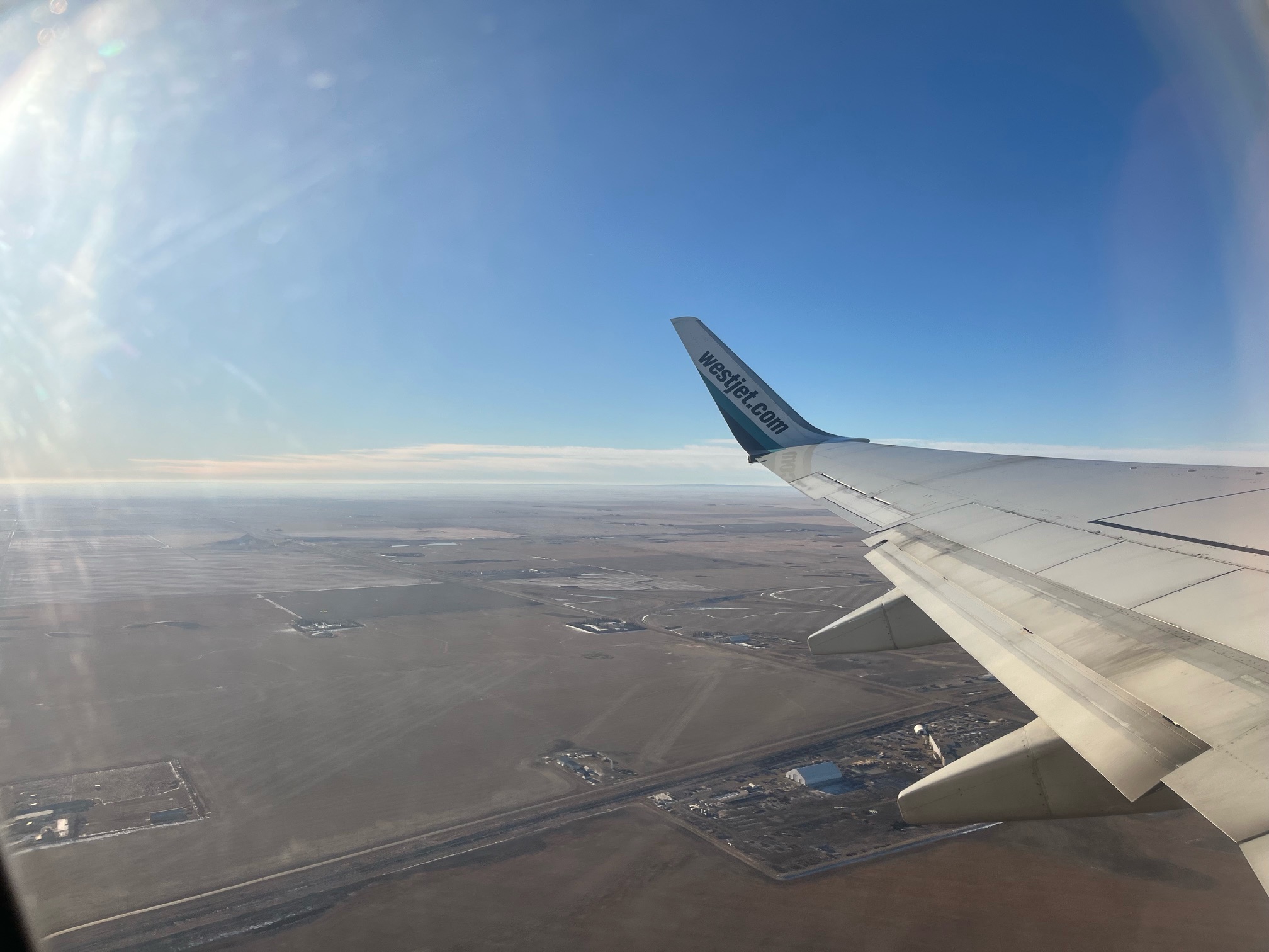
So these photos are between the Canadian provinces of Saskatchewan, Alberta and British Columbia. Where central Canada is much more flat, you can see the Rockies in some of these photos – but I just want to point out how little there is in terms of human activity. Sure the landscape itself may not be ideal for development, but even all this forest can’t be covered by hikers and offroaders 24/7. To view the forest from a plane up high like this, let’s say you use thermal imaging – I can only imagine how difficult it would be to see anything remotely similar to Bigfoot pop up in infrared. The trees are so dense overhead and that’s if you even manage to reach the tree canopy because in this photo here for example – it’s almost like an ocean in between the mountains, the clouds and fog just blanket the land.
The importance of this is can Bigfoot retain the knowledge to navigate when the weather suits him? I don’t think it’s entirely out of the question, especially if it’s true they travel miles within 24 hours. So let’s say they can tell when a nice fog descends on the land, perhaps they would deduce this is ideal travel conditions when humans aren’t nearby? And overhead planes and such also can’t see them. It would be like your home with no parents for the first time and you can do what you want sorta speak.
Now we have to take into account here the terrain of these provinces and the sightings, while British Columbia is rich in forest and mountains that only expand as you get closer to the Rockies into Alberta, Saskatchewan is pretty barren and flat, with a plethora of farmland. Something hiding there would be very difficult because as I said, it’s flat open terrain.
British Columbia’s population – 5.5 million as of 2023.
Alberta’s population – 4.7 million as of 2023.
Saskatchewan’s population – 1.2 million as of 2023.
At this point of our episode, Reuben transitions the topic to the Mercator’s map and our continental proportions.
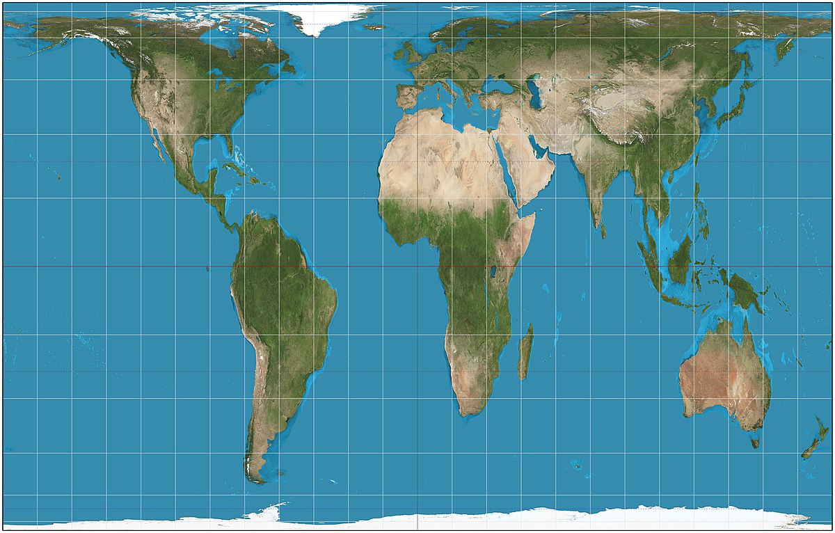
Honestly, the idea behind my bringing this up is to relate this episode to how massive the wilderness is in other parts of the world. If you think, if you truly think, that North America has a massive amount of unexplored land… then just wait until you hear about the rest of the globe. First of all, we’ve been using the Mercator’s map from the 1970’s for some time. This map inflates Canada and Russia to about 25% of the Earth’s surface when in reality they take up about 5%. Greenland is inflated to 4.5 the size to the point it could swallow up Canada. All of the Northern Hemisphere suffers from this inflation but those are the worst offenders. Number-wise, Canada is 9 million km squared but Greenland is only 2 million km squared. Look at any common map and tell me Greenland looks any bit smaller.
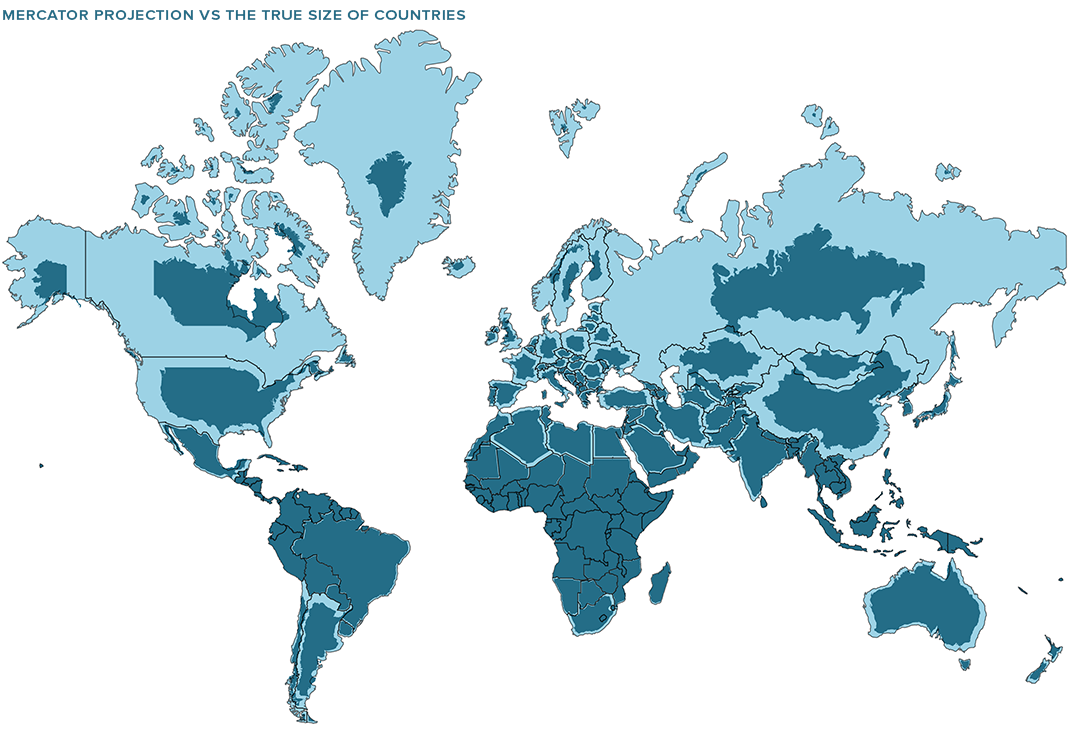
The fact that we’re taught in schools using images showing the incorrect scale while we read the correct information in kilometres and such boggles my mind and throws this whole thing off to the wacky train. Why haven’t we made an effort to fix this? Is it so that we feel like superior countries? We actually have, in the 1980’s the Gall-Peter’s projection map was made but in comparison, it looks like a poorly stretched image in Photoshop. Nobody likes it, so it’s not used.